 Spanish
  Chinese
  Russian
  German
  French
  Japanese
  Portuguese
  Hindi
Hindi Research Article, Geoinfor Geostat An Overview S Vol: 0 Issue: 0
Impact of High-speed Railway on Urban Spatial Expansion along the Line and its Measurement Analysis-In the Case of Beijing-Shanghai HighspeedRailway
Kaiyong Wang*
Key Laboratory of Regional Sustainable Development Modeling, Institute of Geographic Sciences and Natural Resources Research, Chinese Academy of Sciences, Beijing, China
*Corresponding Author : Kaiyong Wang
Key Laboratory of Regional Sustainable Development Modeling, Institute of Geographic Sciences and Natural Resources Research, Chinese Academy of Sciences, Beijing, China
Tel: + 010-64888147
E-mail: wangky@igsnrr.ac.cn
Received: April 18, 2018 Accepted: July 11, 2018 Published: July 18, 2018
Citation: Wang K (2018) Impact of High-speed Railway on Urban Spatial Expansion along the Line and its Measurement Analysis-In the Case of Beijing- Shanghai High-speed Railway. Geoinfor Geostat: An Overview S3. doi: 10.4172/2327-4581.S3-001
Abstract
Since the Medium and Long-term Railway Network Plan was promulgated, high-speed railway construction in China entered a stage of large-scale development and China gradually ushered in the age of high-speed railway. As urbanization sped up, the railway exerted major influence over the development of cities and areas along the line. The paper takes remote sensing images of cities along the Beijing-Shanghai High-speed Railway as basis and resorts to GIS technology and multiple research methods to comparatively analyze and measure the impact of this particular railway on spatial expansion of cities along the line from 2005 to
2014. Result of the research indicates that from 2005 to 2014, size of built-up areas in cities along the Beijing-Shanghai Highspeed Railway expanded by 54.28%, and overall expansion speed and intensity of the cities along the Beijing-Shanghai Highspeed Railway were both 6.78%, which signaled that the railway promoted the spatial expansion of the cities. The southern cities, such as Shanghai, Changzhou, Suzhou in Jiangsu, become the hot areas of the spatial expansion. And the spatial expansion of the cities differed in speed and intensity and the direction of expansion showed anisotropy.
Keywords: Urban spatial expansion; Impact of speed, intensity and direction; Beijing-shanghai high-speed railway
Introduction
China is entering the era of high-speed railway: the pattern of “four horizontal and four vertical” [1] has been proposed by Longterm railway network planning and The Network Planning of Chinese High-Speed Rail will cover major cities. The four horizontal lines are Shanghai-Wuhan-Changsha high speed railway, Xuzhou-Lanzhou passenger special line, Shanghai-Kunming high speed railway and Qingdao-Taiyuan passenger special line. The four vertical lines are Beijing-Shanghai high speed railway, Beijing-Hongkong passenger special line, Beijing-Harbin passenger special line and Hangzhou Fuzhou-Shenzhen passenger special line. In September 2007, the construction of Beijing-Shanghai high-speed railway became a prelude. Till the end of 2015, the high-speed railway operating mileage of China was 19,000 km, ranked as the top [2]. High-speed railway network shortens both time and distance among cities to optimize the traffic pattern, as well as playing a vital role on economy and spatial structure in surrounding areas [3]. Clearly, the future development of the cities will be concentrated on the construction of regions along the high-speed railway.
According to the current researches, the impact of high-speed railway on city development can be classified into three aspects: (1) “High-speed railway economic effect”, that is, high-speed railway has transformed the linked-cities into a functional district; promote social and economic development through the improvement of transport facilities [4-9]. (2) Through the construction of high-speed railway network, we can optimize the accessibility of cities along the lines, and shorten the both time and distance among cities [10-14]. (3) The construction of high-speed railway will indirectly change the spatial structure and land use of the city, especially in those surrounding areas of high-speed rail [15-17]. In addition, advanced GIS technology for spatial analysis and mathematical statistics method simplify the researches on high-speed railway effect. Among all applied technologies, the 3S space technology has being favored to acquire the relevant data of urban land. In the meanwhile, researchers will adopt the index of expansion, parting and etc. to make the study accurate [18-20]. Another function of GIS, that is map display, could reflect the regional diversity in spatial structure in a more direct and clear manner.
In summary, many researchers have done plenty of studies on high-speed railway and urban growth. But most studies merely aim at big cities or popular districts like Yangze River Delta or Beijing- Tianjin-Hebei, while regardless of cities along the route or in the nearby areas. There are few studies on the impact of high-speed railway on geographical elements like the use of land, the expansion of city and the morphology of landscape. This study introduces Beijing-Shanghai high-speed railway and the impact of high-speed railway on expansion of urban land and changes of spatial pattern. All measurements are taken in consideration of degree of expansion and changes of landscape to ensure the accuracy.
Data and Methodology
Study area
Beijing-Shanghai High-speed Railway lies in North China and East China for a length of 1,318 Km. It runs through three municipalities including Beijing, Tianjin and Shanghai and four provinces including Hebei, Shandong, Anhui and Jiangsu, connects Circum-Bohai Sea Economic Zone and Yangtze River Delta Economic Zone and has 23 stations along the way (Figure 1). The railway started construction on April 18, 2008 and was opened for traffic on June 30, 2011. Study in the paper covers 19 cities that the railway runs through, namely Beijing, Langfang, Tianjin, Cangzhou, Dezhou, Jinan, Tai’an, Qufu, Zaozhuang, Xuzhou, Suzhou, Bengbu, Chuzhou, Nanjing, Zhenjiang, Changzhou, Wuxi, Suzhou and Shanghai.

Figure 1: Beijing-Shanghai High-speed Railway.
Data
Data used in the paper is mainly derived from land use map for 2005 of the study area and its Google Earth high-definition satellite images for 2014. The former, at a resolution of 100 × 100 m, is downloaded from a data website named the cloud platform in national geographical monitoring, while the latter is accessed by putting together images obtained via Google Earth data downloader. Social and economic data included administrative area, built-up area, etc., mainly from the Chinese urban statistical yearbook from 2006 to 2015.
Methodology
Deriving land use area from the satellite images: In order to learn about the distribution of built-up areas in 2014, the satellite images are first registered to the administrative division map via the software ArcMap 10.2 platform, and then vectorized through artificial interpretation combined with supervised classification, so as to extract image patches of the built-up areas in the cities. The distribution of built-up areas in 2005 is accessed by re-classifying land use map. Finally, the image database of the study area is set up and the function of overlay analysis is utilized to conduct calculations and statistical analysis over the expansion of built-up areas in the cities in 2005 and 2014 (Figure 2).

Figure 2: The spatial expansion of urban built-up areas along Beijing-Shanghai High-speed Railway in 2005 and 2014.
Speed and intensity of expansion: Index of Expansion Speed (M) and Index of Expansion Intensity (I) are two major indicators for quantitatively assessing the course of urban spatial expansion. Speed of urban spatial expansion shows annual average growth rate of a city at different stages within a study period and reveals the general trend of expansion. Intensity of the expansion is intended to standardize the annual average growth rate of land for construction of each spatial unit in the study area to make the growth rate at different stages comparable, so as to analyze and describe the expansion status of built-up areas in the cities and compare intensity, speed and trend of the size expansion at different stages and locations [21].
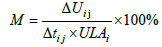 (1)
(1)
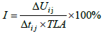 (2)
(2)
In the formula, ΔUij refers to area difference of built-up areas in the cities between time points i and j. Δtij refers to time span between time points i and j, ULAi area of built-up areas at the time point i and TLA area of built-up areas at the initial time.
As the study only focuses on the changes with spatial expansion of cities along the Beijing-Shanghai High-speed Railway in 2005 and 2014 for comparative analysis, the speed and intensity of expansion are set to be equal in value.
And in order to detect the influence brought by the high-speed railway, this study calculated the speed and intensity of expansion of the cities where no high-speed railway lines pass for comparative analysis.
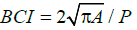
Compactness: Compactness of urban form reflects the degree of spatial concentration of various parts within the spatial form of a city and is regarded to be a very important concept for reflecting urban spatial form. There are multiple ways to calculate the compactness, while the formula proposed by Cole and Batty is most widely used [22].
The paper uses the formula proposed by Batty for compactness calculation:
 (3)
(3)
To be specific, BCI refers to compactness of urban land; A refers to area of built-up areas in a city and P perimeter of city silhouette. The value of BCI ranges between 0 and 1; the larger the value-higher the compactness.
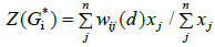
Spatial auto-correlation: Spatial autocorrelation, based on spatial weights, reveals the spatial pattern and structure characteristics of urban expansion by measuring similarity and difference of spatial expansion of cities at the level of fields [23,24]. The paper adopts hotspot analysis (Getis-Ord Gi*) to identify the spatial distribution of high-value and low-value clusters and hot spots as well as cold spots at different spatial locations, so as to verify the impact of the Beijing- Shanghai High-speed Railway on spatial expansion of the cities along the line.
Getis-Ord Gi* is expressed as:
 (4)
(4)
Gi*(d) is standardized as follows:
 (5)
(5)
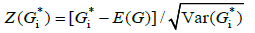
In the formula, d refers to distance between various city centers, xi and xj index of expansion intensity of cities i and j, E(G) and Var(Gi*) mathematical expectation and variance of Gi* and wij spatial weight. If Z(Gi*) is positive and significant, value around the location i is relatively high, making the area a high-value spatial cluster, i.e., a hot-spot area; if Z(Gi*) is negative and significant, value around the location i is low, making the area a low-value cluster, i.e., a cold-spot area.
Impact on Spatial Expansion of Cities along the Line and its Measurement
Change with expansion size
As indicated by the change with the size of built-up areas, spatial expansion of the cities along the Beijing-Shanghai High-speed Railway showed an explicit trend of growth. The total area rose from 4,532 km2 in 2005 to 6,992 km2 in 2014, up 2,460 km2 or more than half of the size of built-up areas in 2005. Such dramatically major change of the size in less than ten years was inseparable from the constant acceleration of urbanization and the construction of highspeed railway-based news towns after completion of the Beijing- Shanghai High-speed Railway. Statistics showed that after the railway was completed, a total of 16 cities along the line (such as Suzhou, Nanjing and Wuxi) planned for or developed new towns, with area ranging from several square kilometers to tens of square kilometers, injecting new vigor to spatial expansion of the cities during this period. It’s fair to say that construction of the railway promoted the land development in the cities along the line to some extent and turned into one of the drivers for spatial expansion of the cities.
In addition, in order to reflect the impact of the high-speed railway on the space expansion of the construction land, we calculated the area growth rate of the construction land of other cities in Hebei, Jiangsu, Shandong and Anhui provinces. Considering the accuracy of the results, we eliminated the provincial cities (Shijiazhuang, Hefei) and the central city (Qingdao).
According to Table 1, the average area growth rate of the construction land of cities along the rail line in Hebei, Anhui and Shandong is higher than other cities in these provinces. It shows that high-speed railway has promoted the space expansion of urban construction land to some extent. The exception in Jiangsu province is mainly due to the cities, such as Nanjing, Wuxi and Suzhou, have strong social and economic development strength, and the construction land expansion potential is limited, so the high-speed railway effect is relatively weak.
| Province | Cities Along the Railway Line | Other Cities |
|---|---|---|
| Hebei | 5.52 | 4.95 |
| Jiangsu | 9.45 | 13.04 |
| Anhui | 11.56 | 6.38 |
| Shandong | 13.13 | 10.05 |
Table 1: Average area growth rate of construction land from 2005 to 2014 (%).
Speed, intensity and direction of spatial expansion
Calculation based on the formula (1) and (2) shows that from 2005 to 2014, overall expansion speed and intensity of the cities along the Beijing-Shanghai High-speed Railway were both 6.78%, but the speed and intensity between the cities greatly differed (Figure 3). During the period, the city with the greatest speed and intensity of spatial expansion was Suzhou (including Kunshan), which was recorded at 26.09%, and the cities that expanded relatively fast were Dezhou, Changzhou and Wuxi. The city with the lowest speed and intensity was Beijing, which was recorded at 1.26%, and some other cities such as Bengbu and Tai’an also showed a trend of slow expansion.

Figure 3: The expansion intensity of the cities along Beijing-Shanghai High-speed Railway from 2005 to 2014.
As we know that, overall, medium sized cities have been experiencing strong urban expansion during the last decade, mainly due to economic reasons. In order to avoid the influence of this factor, we compared the spatial expansion degree between medium sized cities along the high-speed railway and other medium sized cities. The average expansion intensity of the whole medium sized cities in China was 7.89%, while the medium sized cities along the Beijing- Shanghai High-speed Railway was 13.2%, which was far higher than the national average. This once again proved that the Beijing- Shanghai High-speed Railway plays an important role in promoting the spatial expansion of urban construction land.
Regarding the direction of expansion, spatial expansion of the cities displayed anisotropy. The expansion of the most cities showed a trend of extending along the Beijing-Shanghai High-speed Railway. Some cities, such as Suzhou (Jiangsu) and Dezhou, apparently expanded towards the railway, some, such as Cangzhou and Bengbu, didn’t show any obvious trend because their expansion intensity was low, and a few cities, such as Suzhou (Anhui), were subject to limited influence of the railway despite the high expansion intensity. In order to reflect and explain the reasons more intuitively, Suzhou in Jiangsu, Dezhou, Cangzhou, Bengbu and Suzhou in Anhui (Figure 4) will be taken as examples to indicate the impact of the railway on their spatial expansion. The main reason that these cities were chosen is that these cities have experienced a rapid expansion process after the construction of high speed railway, which are typical and obvious to analyze their changes.

Figure 4: The expansion map of some typical cities along Beijing-Shanghai High-speed Railway from 2005 to 2014.
From 2005 to 2014, Suzhou and Dezhou turned out to be the top two cities among those along the Beijing-Shanghai High-speed Railway in terms of speed and intensity of urban spatial expansion. As the railway was constructed and opened for traffic, Suzhou North Station and Kunshan South Station were set up within Suzhou, catalyzing the birth of the “Along the High-speed Railway” Economic Belt in the city and promoting the urban space to extend towards and along the railway stations. Suzhou also proposed in its 12th “Fiveyear” Plan to seize the opportunity of the railway to develop highspeed railway-based new towns. Dezhou, a city that rises because of traffic and lies as the northern gate of Shandong, was brought new opportunities of leapfrog development by construction of the railway. As planned, the city will rely on Dezhou East Station and plan for a high-speed railway-based new town with an area of up to 56 square kilometers to develop its traffic and business district, which will also serve as an important growth pole of the city in the future. At present, the central downtown area is also rapidly expanding eastwards.
Suzhou and Dezhou are both typical examples of Beijing-Shanghai High-speed Railway boosting rapid expansion of urban space, while Cangzhou and Bengbu are low in the degree of expansion. From 2005 to 2014, Cangzhou and Bengbu were low in the speed and intensity of expansion, even less than the half of the level of Dezhou. Though Cangzhou is actively making efforts to integrate into the “One-hour Economic Zone” to Beijing and Tianjin and Bengbu has planned for a high-speed railway station district, due to limitations in their own economic strength and policy, space of the cities has shown a marginal trend of expanding towards the Beijing-Shanghai Highspeed Railway. However, the potential in the future is promising.
Suzhou is located in the north of Anhui. From 2005 to 2014, its urban space expanded rapidly with high intensity, reaching 10.16%. Though the Beijing-Shanghai High-speed Railway passed through the city and Suzhou East Station was set up to the east of its downtown area, since the station was far from the downtown area (23 km for linear distance), the railway contributed little to its spatial expansion and exerted limited influence, making only a marginal driver for the expansion.
Degree of expansion intensification
Based on Batty’s compactness formula (3), compactness index of the cities along the Beijing-Shanghai High-speed Railway for 2005 and 2014 is calculated respectively (Figure 5). It can be seen that from 2005 to 2014, the index for the cities all increased, indicating that the cities were further compact and their space was further intensified. To be specific, Suzhou experienced the greatest change with compactness, followed by Wuxi, and Beijing experienced the smallest change. From 2005 to 2014, Suzhou seized the major opportunity presented by the Beijing-Shanghai High-speed Railway to actively expand its urban space towards the railway and plan for and construct the high-speed railway-based new town. As the newly-built district was developed after rigorous planning, the compactness index was high and the urban space was highly intensified. For Beijing, as the downtown area was already large in size and quite orderly in layout, construction of the railway caused only limited change with its compactness. To sum up, the Beijing-Shanghai High-speed Railway promoted the urban space of the cities along the line to be further intensified.

Figure 5: The compactness index of the cities along Beijing-Shanghai High-speed Railway from 2005 to 2014.
Expansion hotspot analysis
The spatial correlation index Getis-Ord Gi* of the cities along the Beijng-Shanghai High-speed Railway is first calculated and then the hotspot analysis tool ArcGIS10 is used to categorize the statistics of Getis-Ord Gi* (hotspot index) to five groups in the order of high to low value, resulting in the distribution map (Figure 6) of “hotspot areas” (high-value areas) and “cold-spot areas” (low-value areas) in terms of spatial expansion intensity of the cities along the line.

Figure 6: The spatial correlation index Getis-Ord Gi* of the cities along the Beijng-Shanghai High-speed Railway.
The result shows that the “hotspot areas” are apparently centralized into a distinct kernel around Shanghai, Suzhou, Wuxi and Changzhou. The area is one of the most economically developed and fastest urbanized areas in China so far and also one of the areas with rapid spatial expansion and under major influence of the Beijing-Shanghai High-speed Railway. The next high-value area right afterwards is Dezhou and Zhenjiang, which two are also rapidly expanding in urban space. Mid- and low-value areas are mainly distributed in cities under minor influence of the railway (such as Langfang and Cangzhou) or cities that are already large in urban space and have limited space to expand (such as Beijing). The hotspot map of the spatial expansion of the cities also validates the difference in the impact of the Beijing-Shanghai High-speed Railway on the spatial expansion of various cities along the line.
Conclusion and Discussion
The study utilizes Google Earth satellite images and the GIS technology and uses multiple methods to comparatively analyze and measure the influence of the Beijing-Shanghai High-speed Railway on spatial expansion of the cities along the line from 2005 to 2014, presenting the following results. The high-speed railway did promote the land development and urban spatial expansion of the cities to some extent, especially the construction of high-speed railwaybased new towns. At the same time, the effect of Beijing-Shanghai high-speed railway on the spatial expansion of different cities was different. The southern cities, such as Shanghai, Changzhou, Suzhou in Jiangsu, become the hot areas of the spatial expansion. And the spatial expansion of the cities differed in speed and intensity and the direction of expansion showed anisotropy.
Through this result, we can clearly recognize the important role of the high-speed railway for the spatial expansion of the cities along the line. Rapid urbanization has greatly influenced the evolution of urban spatial structure in past years, especially for small and medium sized cities. However, the construction of the high-speed railway network directly shortened the time and distance among cities, provided a good traffic condition for the flow of production, made the urban built-up land gather gradually to the high-speed railway stations, and built a new urban sub center.
The paper extracts statistics on size of urban built-up areas based on Google Earth satellite images. Since artificial interpretation and supervised classification that are used for data extraction are subject to major influence of subjective factors, more effective imagery acquisition methods and image processing software are needed to get more accurate result. Besides, the paper mainly focuses on the macro aspect to analyze the impact of the Beijing-Shanghai Highspeed Railway on spatial expansion of the cities along the line, but the specific mechanism of action and mode of influence remain to be further studied.
Actually, medium sized cities have been experiencing strong urban expansion during the last decade, mainly due to economic reasons. In this case, the expansion of the city occurs mostly around the built-up area. When this urban expansion took place around the high-speed rail station, it was considered to be the main reason caused urban expansion. The presentation of the results of this paper mainly on the indicator of urban expansion, it need further study by comparing those results within the selected perimeter with data at a national level. Another topic need to be study in the future is that to what extent urban expansion identified in the medium sized cities within the perimeters is related to the opening of the new high speed line, and this need more empirical research. This paper is an exploration and beneficial attempt, and many cases need to be analyzed and demonstrated later.
References
- Qingyun W, Xiaoqi Z (2008) Practice Scientific Outlook on Development optimization integrated traffic network structure-Medium and long term railway network planning (2008 adjustment) analysis. Comprehensive transport 12: 4-6.
- Bazin S, Beckerich C, Delaplace M, Blanquart C, Vandenbossche L (2011) High-Speed Rail Service and Socio-Economic Transformations in Local Areas, A Review. In 90th Annual Meeting of Transportation Research Board, Washington, DC USA.
- Limin Z (2011) Study on the Strategies of Building High-speed Railway Urban Spatial form and Landscape Architecture in the General Areas of High-speed Rail Site. Huazhong University of Science and Technology, Wuhan, Hubei, China.
- Xueyan L (2013) The influence analysis of China’s high-speed railway development on less developed cities. Dongbei University of Finance& Economics, Liaoning Sheng, China.
- Blum U, Haynes KE, Karlsson C (1997) Introduction to the special issue The regional and urban effects of high-speed trains. Annals Reg Sci 31: 1-20.
- Sun F, Mansury YS (2016) Economic Impact of High-Speed Rail on Household Income in China. Transportation Research Record: Transportation Res Board 2581: 71-78.
- Vickerman R (2015) High-speed rail and regional development: the case of intermediate stations. J Transp Geogr 42: 157-165.
- Chen Z, Xue J, Rose AZ, Haynes KE (2016) The impact of high-speed rail investment on economic and environmental change in China: A dynamic CGE analysis. Transp Res Part A Policy Pract 92: 232-245.
- Chaolin G (1999) Economic Globalization and China Urban Development Study on Trans-century China Urban Development Strategy. The Commercial Press, Beijing, China.
- Daluwatte S, Ando A (1995) Transportation and regional agglomeration in Japan: Through a longterm simulation model 1920-85. Adv Transportation 29: 213-233.
- Linneker BJ, Spence NA (1992) Accessibility measures compared in an analysis of the impact of the M25 London Orbital Motorway on Britain. Env Planning A 24: 1137-1154.
- Chen H, Sun D, Zhu Z, Zeng J (2016) The impact of High-Speed Rail on residents’ travel behavior and household mobility: A case study of the Beijing-Shanghai Line, China. Sustainability 8: 1187.
- Sanchez-Mateos HS, Givoni M (2012) The accessibility impact of a new High-Speed Rail line in the UK–a preliminary analysis of winners and losers. J Trans Geog 25: 105-114.
- Ortega E, Monzon A, Lopez E (2018) The influence of spatial data allocation procedures on accessibility results: The case of high-speed rail networks. App Geog 94: 241-250.
- Pol PM (2002) A renaissance of stations, railways and cities. Economic effects, development strategies and organisational issues of European high-speed-train stations. Delft University Press, Delft, Netherlands.
- Jiao W, Xuejin D (2011) High-speed Rail and Its impacts on the Urban Spatial Structure of China. 6: 49-54.
- Liu JL, Yin Y, University YN (2016) The Impact of Transport-Tourist Experience of High-Speed Rail on the Tourism Spatial Structure in Medium and Small Cities-A Case Study of Fuling. Economic Geog 36: 58-71.
- Huang H, Yun Y (2012) Urban expansion in the core area of Tianjin based RS and GIS. J. Arid Land Resourc. Environ 7: 165-171.
- Shang ZY, Zhang XL, Zhou XZ (2012) Study on urban spatial expansion and external morphology evolution based on RS/GIS: A case of Huai’an city. Economic Geog 32: 64-70.
- Sañudo R, Luis Moura J, Cordera R, Ibeas A (2017) Optimal Stopping Location of a High Speed Train using GIS and Multicriteria Decisionâ€Âmaking. Transactions in GIS 21:151-168.
- Shenghe L, Chuanjun W, Hongquan S (2000) A GIS based Model of Urban Land Use Growth in Beijing. Acta Geographica Sinica 55: 407-416.
- Jiyuan L, Xinsheng W, Dafang Z (2003) Application of Convex Hull in Identifying the Types of Urban Land Expansion. Acta Geographica Sinica 58: 885-892.
- Fahui W (2009) Quantitative Methods and Applications in GIS. The Commercial Press, Beijing, China.
- Ding Jun, Wang Kai Yong. Spatial and temporal evolution and driving mechanism of industrial production space in Pearl River Delta urban agglomeration [J]. geography research, 2018 (1): 53-66.

